-
 7 1.1.22025-04-03 Latest Version
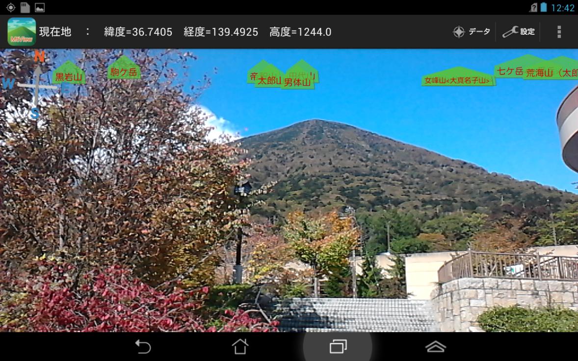
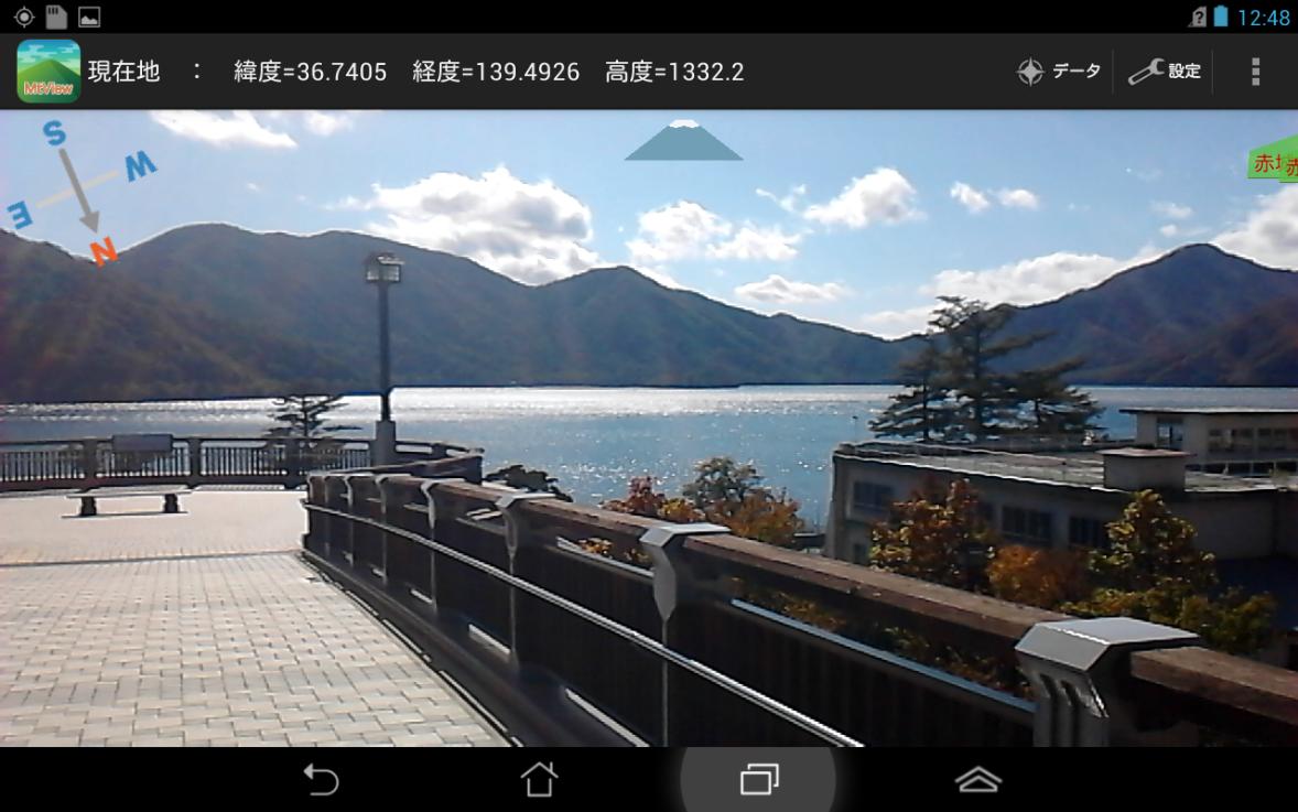
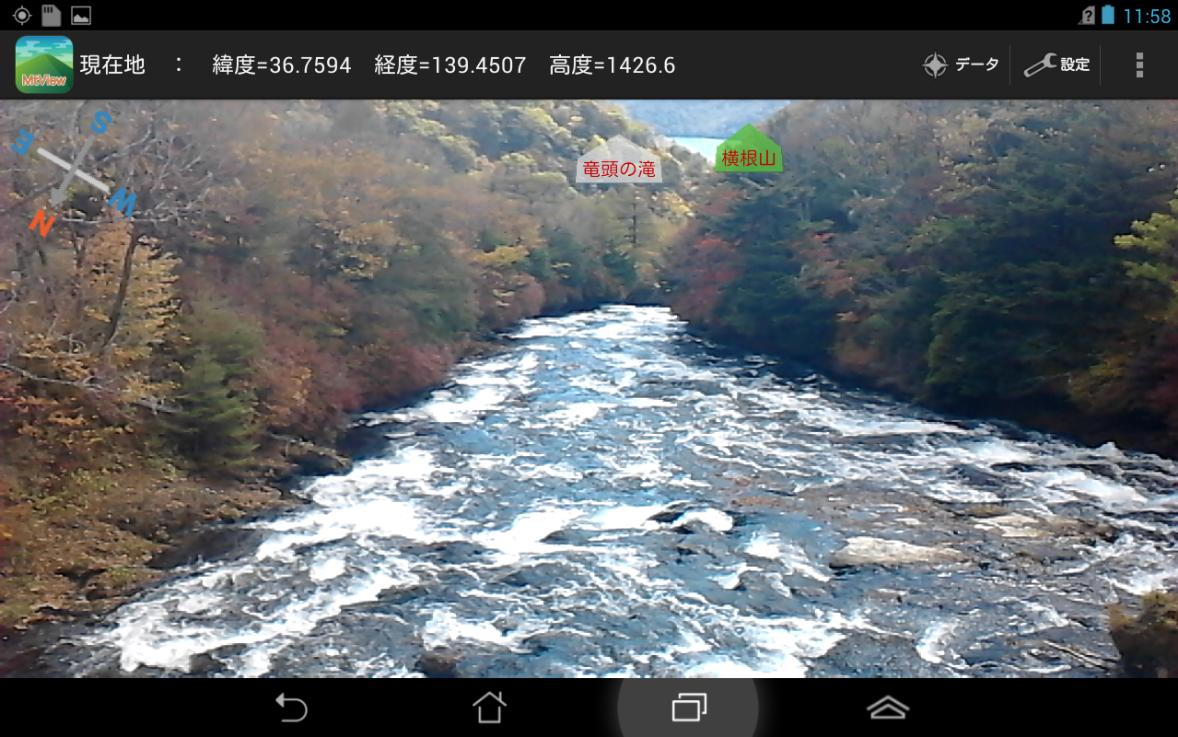
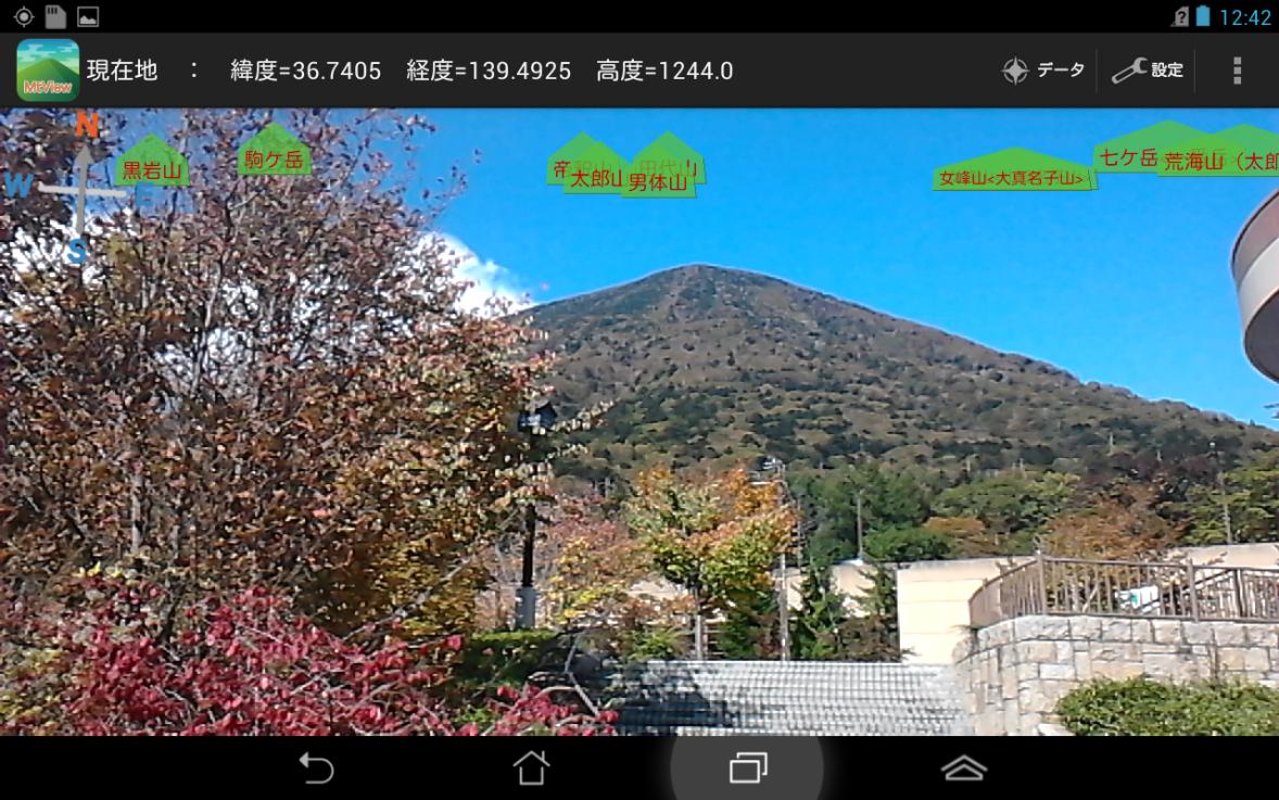
MtView Some of scenery as seen by the camera, is an application that displays the name of the mountain that looks to its direction.
MtView is an app that displays the names of mountains that appear in that direction in the view seen with the camera.
This is useful for identifying mountain seats when climbing or trekking, or for those who want to know the names of mountains that are visible far from the city.
[Overview function]
-The names of nearby mountains (30 locations) obtained through GPS, centered around the current location will be displayed in the view seen with the camera.
・When you view the data, you will see the names of 30 mountains, distances, directions, elevations, and whether they are 100, 200, 300, or more.
・Touch the mountain name displayed in the mountain list to display the reading and location of the mountain name.
-There is a correction function if the direction or angle of view differs depending on the model.
- We carry data on over 1,000 mountains across Japan. (We do not communicate any data acquisition.)
- Users can add/delete custom data unique to them. You can choose the type of custom data: mountain or other.
- When set to Mt. Fuji mode, data for Mt. Fuji will always be displayed.
[Notes]
- When you first start up, Tokyo Skytree will be your current location. (Please wait a little while until you get your location information. Please update the list once you have obtained your location information.)
-When starting up after that, the current location is the location where the location information was last acquired.
-The 30 mountains displayed will be selected in order of their current location at startup or in the order they were closest to when the list was updated.
- Operation checks are performed using the "ASUS Fonepad ME371MG". It is unknown whether it will work on other models.
(If an error occurs, try turning off the power and then try booting it again. If the error still occurs, please report the error.)
-The accuracy of GPS and directional sensors varies greatly depending on the model.
・The method of obtaining directions has been changed in ver1.1. New orientation correction settings may be required.
-The strength of the magnetic field can be displayed on the screen. If the text color is yellow or red, it may be that the correct direction cannot be obtained due to the influence of the magnetic field.
- A rear camera is required to use this app.
When creating this app, we have stored data on over 1,000 mountains based on the Geospatial Information Authority of Japan's Main Mountain Elevation, but this may not be reflected correctly in this app. Users of this app should read the following warnings carefully before using.
[Warnings]
- Please do not use this app to make important decisions.
- We cannot guarantee that the operation of this app will occur.
- There may be errors in the data used in this app.
- The app developer is not responsible for any damages caused by the use of this app.
- Use will only be permitted if you agree to use it at your own risk.
What's New in the Latest Version 1.1.2
Last updated on Aug 7, 2015 - The following features have been added.(1) Mount Fuji mode settings
(2) Add/delete custom data function
(3) Basic data display function by prefecture (ver1.1.2)
・The icon has been changed.

